AWARD YEAR
2023
CATEGORY
Community
GOALS
Decent Work & Economic Growth, Industry, Innovation & Infrastructure, Sustainable Cities & Communities
KEYWORDS
Data Visualizations, Data analytics
COUNTRY
United States of America
DESIGNED BY
Peter Calthorpe, Joe DiStefano
WEBSITE
https://urbanfootprint.com/
Urban Footprint
The world’s first urban intelligence platform
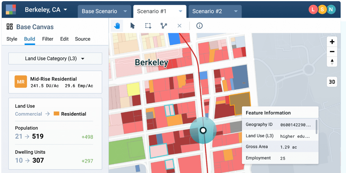
How does it work?
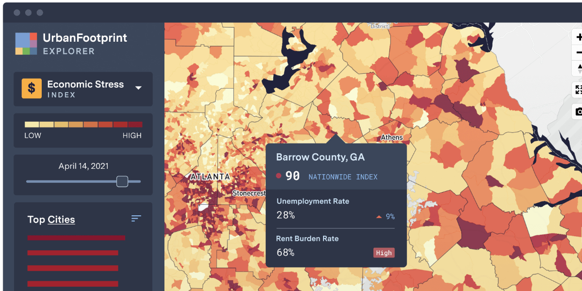
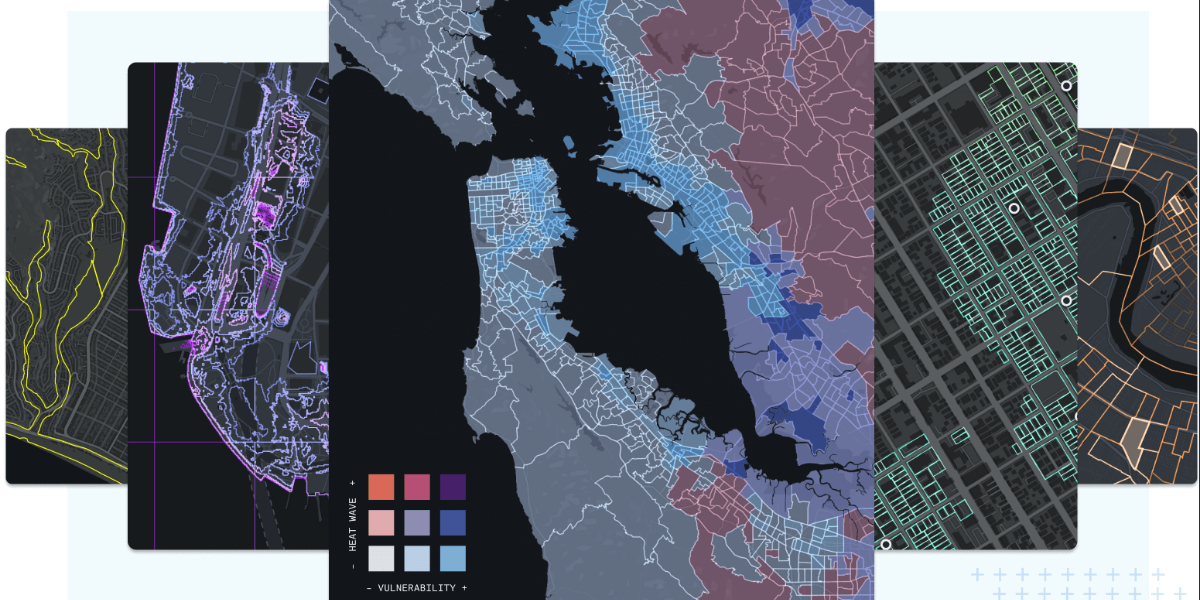
Assess risk, understand markets, and make better decisions with the most powerful and comprehensive urban, climate, and community resilience data platform available anywhere. Assess existing conditions and land use down to the parcel level with granular urban, environmental, and mobility data. Analyze and intersect vulnerabilities, impacts, and policy interventions at the state, city, and neighborhood level. Evaluate the impacts of climate change and natural hazards on communities, resources, and infrastructure.
Why is it needed?
We believe that organizations equipped with the best data and latest tools make more sound decisions. Accelerating climate change, deepening social inequities, and the profound, disparate impacts of the COVID-19 crisis have all laid bare the inadequacy of current systems to provide decision makers with the clear and honest information they need to drive effective and equitable decisions.
How does it improve life?
We serve governments, enterprises, and other stakeholders with comprehensive, granular, and context-rich data about the urban and natural landscape, paired with highly targeted insights that map and measure risk and opportunity, to prioritize investments and resources where they’re needed most.