AWARD YEAR
2023
CATEGORY
Play & Learning
GOALS
Quality Education, Climate Action
KEYWORDS
Google Earth , environment, visualization
COUNTRY
United States of America
DESIGNED BY
Google + CREATE Lab
WEBSITE
https://blog.google/products/earth/timelapse-in-google-earth/
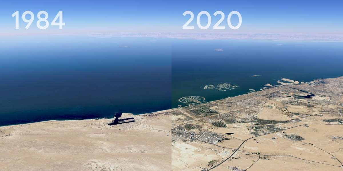
Timelapse in Google Earth
See how the Earth changes over time
How does it work?
For the past 15 years, billions of people have turned to Google Earth to explore our planet from endless vantage points. You might have peeked at Mount Everest or flown through your hometown. Since launching Google Earth, we've focused on creating a 3D replica of the world that reflects our planet in magnificent detail with features that both entertain and empower everyone to create positive change.
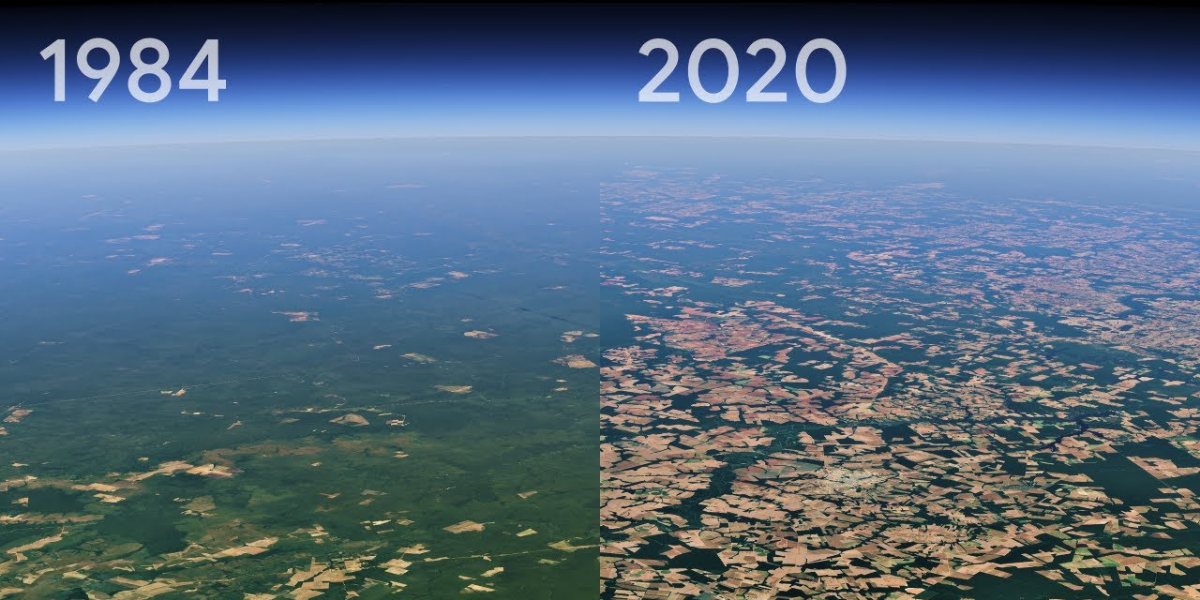
In the biggest update to Google Earth since 2017, you can now see our planet in an entirely new dimension — time. With Timelapse in Google Earth, 24 million satellite photos from the past 37 years have been compiled into an interactive 4D experience. Now anyone can watch time unfold and witness nearly four decades of planetary change.
Why is it needed?
Our planet has seen rapid environmental change in the past half-century — more than any other point in human history. Many of us have experienced these changes in our own communities; thousands of Californians evacuated from their homes during the state’s wildfires last year. For other people, the effects of climate change feel abstract and far away, like melting ice caps and receding glaciers. With Timelapse in Google Earth, we have a clearer picture of our changing planet right at our fingertips — one that shows not just problems but also solutions, as well as mesmerizingly beautiful natural phenomena that unfold over decades.
How does it improve life?
Timelapse in Google Earth is about zooming out to assess the health and well-being of our only home, and is a tool that can educate and inspire action.
Visual evidence can cut to the core of the debate in a way that words cannot and communicate complex issues to everyone. Take, for example, the work of Liza Goldberg who plans to use Timelapse imagery to teach climate change. Or the 2020 award-winning documentary “Nature Now” that uses satellite imagery to show humanity’s growing footprint on the planet.