
AWARD YEAR
2023
CATEGORY
Community
GOALS
Zero Hunger, Sustainable Cities & Communities, Responsible Consumption & Production, Life On Land, Generational Harmony
KEYWORDS
indigenous, mapping, 3d participatory mapping
COUNTRY
Chad
DESIGNED BY
Hindou Oumarou Ibrahim
WEBSITE
https://www.theguardian.com/global-development/2022/aug/25/new-maps-and-local-knowledge-power-chad-climate-fightback-hindou-oumarou-ibrahim?CMP=share_btn_tw
Mapping Survival
Documenting ancestral nomadic routes and dwindling ressources to end conflict and share resources
How does it work?
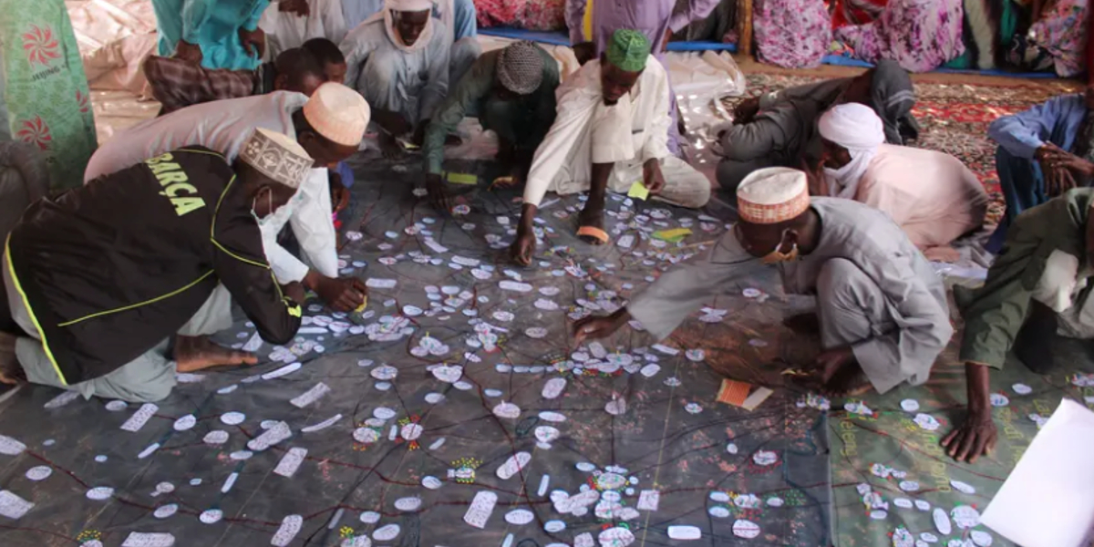
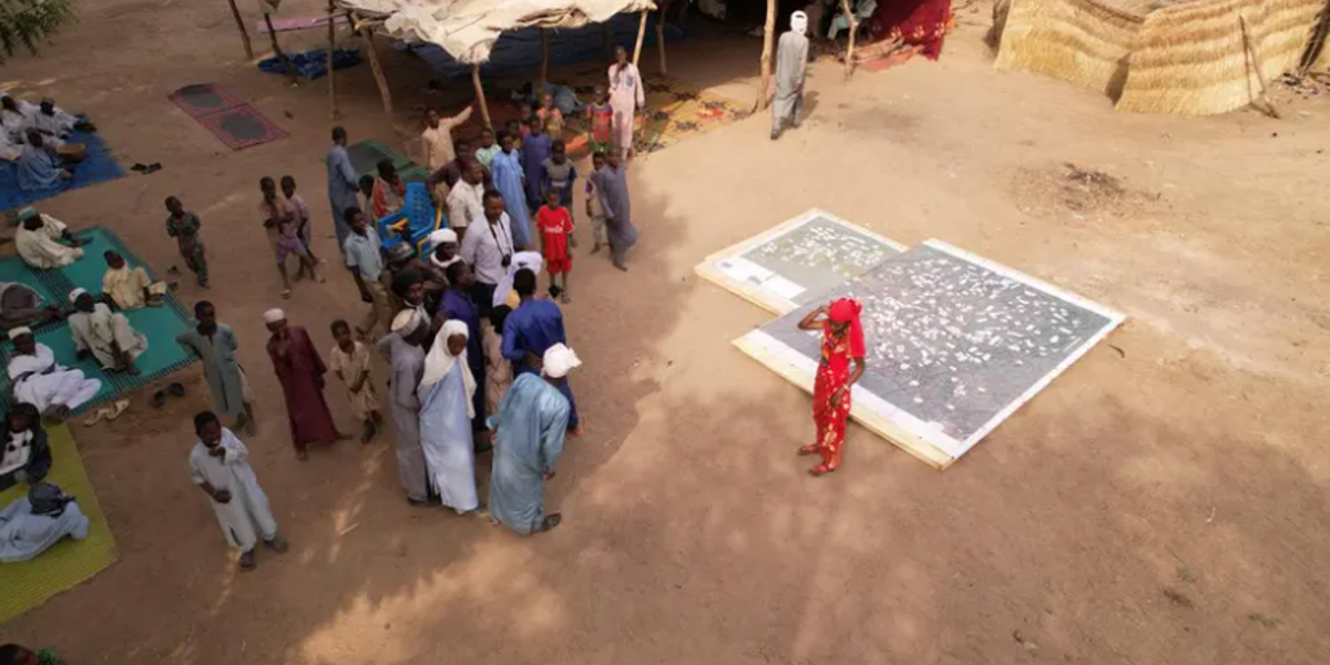
To help mitigate tensions, Ibrahim is working with communities to produce maps to enable them to agree on the sharing of natural resources. Using high-resolution satellite images, Ibrahim and representatives from EOS Data Analytics ran workshops with leaders from 23 villages in Mayo-Kebbi Est to map 1,728 sqkm. People added features such as rivers, settlements and roads, as well as sacred forests, medicinal trees, water points and corridors for cattle. Laminated copies of the maps were distributed to each community. She is conducting a similar exercise on the shores of Lake Chad. It was vital to involve women in the process, not just to ensure their representation, but because of the knowledge they have, such as how to find water in the dry season. “Our best app is our grandmothers because they can just observe the cloud positions, the bird migration... and say, ‘Oh, it’s going to rain in 2 hours."
Why is it needed?
The UN describes Chad as “one of the world’s most environmentally degraded countries”. In 2020, record rainfall caused a huge loss of food stocks and displaced hundreds of thousands while last year’s floods left more than 160,000 homeless. The changing weather has already wrecked the lives of pastoralists, who cannot milk their dehydrated cattle. Desertification has shrunk farming and grazing lands and nomads such as the Mbororo – Ibrahim’s people – and farmers are being pushed into conflict while government and military land grabs have further reduced access to water.
In Chad, people from the north are migrating to the greener south. “It creates conflict between those who are coming and those who are staying and on the natural resources.” Others leave and “finding themselves in Europe without things that they can do”, says Ibrahim. “We are shying away from using the name climate refugee, but we must put it on the table and talk about it.”
How does it improve life?
Indigenous people protect 80 % of the worlds biodiversity. Some of the invaluable knowledge and intelligence indigenous people represents can be mapped through this initiative. The initiative not only ensured that knowledge of lands, ressources and the local environment indigenous people have build up over generations are mapped but also works as a tool for sharing natural ressources in between communities and therefore also avoiding unnecessary conflict.