AWARD YEAR
2023
CATEGORY
Community
GOALS
Affordable & Clean Energy, Sustainable Cities & Communities, Responsible Consumption & Production
KEYWORDS
earth imagery, zero emissions, data tracking
COUNTRY
United States of America
DESIGNED BY
Near Space Labs
WEBSITE
https://nearspacelabs.com/
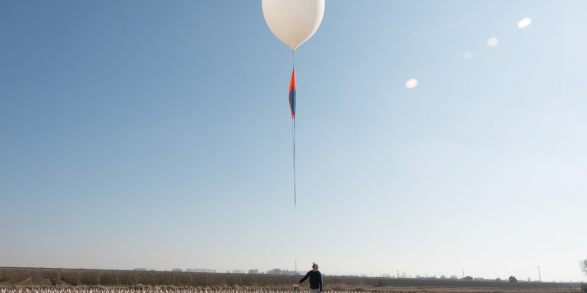
Swifty 3
A one-of-a-kind, eco-friendly solution broadening access to high-quality geospatial Earth imagery
How does it work?
The Swifty is an autonomous, zero-emission, high-altitude robot that makes frequent flights into the stratosphere flying between 60,000 and 85,000 feet in the air – via a sophisticated weather balloon. Swiftys capture a whopping 400 – 1,000 sq km of imagery per flight, roughly the size of all of New York City’s five boroughs, at 10 cm per pixel resolution. Their nimble technology is built with customers in mind – and provides high-resolution, high-frequency imagery with customizable capture abilities. In other words, high-quality geospatial data without tradeoffs.
Why is it needed?
The technology makes user s able to track changes and see details around high-valued assets and spot trends with 10 cm imagery, and able to be used with a high frequency for up to five times a day. And can be used by governments, insurance and conservation purposes.
How does it improve life?
Due to the balloon-based approach the Swifty is carbon-free unlike aircraft and satellite solutions.